Map Reading Skills for Urdu-Medium Social Studies
Maps look simple, but many pupils read them like pictures instead of tools. They notice the colours and shapes yet miss the scale, the symbols, and the directions that carry the real information. This guide teaches map reading skills for Urdu-medium Social Studies: scale, symbols, directions, and river and city locations, with guided exercises. Pupils who practise these four tools can answer map questions confidently instead of guessing.
The Four Tools Every Map Reader Needs
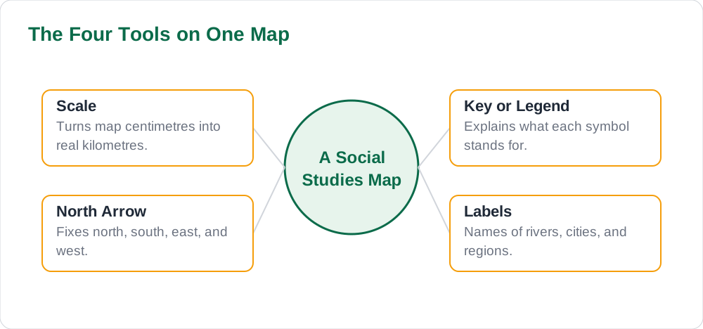
Every map question depends on four tools: scale, symbols, directions, and labels. Scale tells you how distance on the map relates to distance on the ground. Symbols stand for real things such as rivers, roads, mountains, and cities. Directions tell you which way is north, south, east, or west. Labels name the places the map shows. A pupil who checks all four before answering avoids the most common map errors.
Start each map question with a thirty-second scan: find the scale, read the key or legend, find the north arrow, and locate the named places. This habit prevents the classic mistake of answering from memory instead of from the map in front of you. For exam habits that support this kind of careful reading, see how to avoid common exam mistakes.
- Scale: how map distance relates to real distance.
- Symbols: the key or legend explains every mark on the map.
- Directions: the north arrow fixes all other directions.
- Labels: names of rivers, cities, and regions shown on the map.
Scale: Turning Centimetres into Kilometres
Scale is the tool pupils fear most, but it is only a simple ratio. If a map scale says 1 cm represents 50 km, then a distance of 3 cm on the map means 150 km on the ground: multiply the map distance by the scale value. If the scale is given as a ratio such as 1 to 5,000,000, the same idea applies: one unit on the map stands for 5,000,000 of the same units on the ground. Pupils should always write the scale sentence in words before calculating, so the numbers stay meaningful.
Practise with a ruler and a real textbook map. Measure the distance between two cities, multiply by the scale, and write the answer with its unit. Then estimate whether the answer makes sense: two neighbouring cities should not be thousands of kilometres apart. Checking reasonableness catches decimal slips and wrong multiplications. For a fuller method on measurement word problems, see how to solve maths word problems.
- Write the scale in words first: 1 cm stands for how many km?
- Measure carefully with a ruler, then multiply.
- Always write the unit: km, not a bare number.
- Ask whether the answer makes sense for the two places involved.
Symbols, Directions, Rivers, and Cities
Symbols are the map's shorthand. A blue line usually stands for a river, a blue area for a lake or sea, a dot or small circle for a town or city, and a triangle for a mountain peak. The key or legend is the dictionary for these marks, and pupils should never guess a symbol when the key is printed on the same page. In Urdu-medium lessons, pupils should learn the Urdu and English names together, so that darya and river, sheher and city, and samandar and sea are all instantly recognised.
Directions follow from the north arrow. Once north is fixed, south is opposite, east is to the right when facing north, and west is to the left. Rivers flow from high ground to low ground, usually towards a sea or a larger river, so tracing a river downstream often answers a location question. Cities grow where rivers, roads, and fertile land meet, which is why map questions often ask pupils to explain why a city stands where it does.
- Read the key first; never guess a symbol when the legend is printed.
- Learn place words in both languages: darya and river, sheher and city.
- Fix north, then derive south, east, and west from it.
- Trace rivers downstream; cities often stand where rivers and roads meet.
Guided Practice: Reading a Map in Five Steps
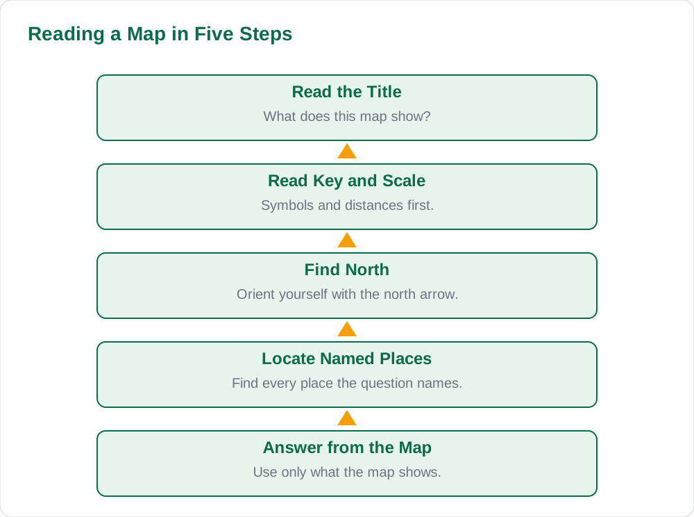
Guided practice turns the four tools into one smooth routine. Step one: scan the title to learn what the map shows. Step two: read the key and the scale. Step three: find the north arrow and orient yourself. Step four: locate the places named in the question. Step five: answer using only what the map shows, quoting distances or directions where the question asks for them. Pupils who follow this routine answer faster and more accurately than pupils who jump straight to the question.
Practise the routine on every map in the chapter, not only on the ones marked for homework. Cover the answers, work through the five steps aloud, and check. Teachers can help by asking pupils to point to each tool on the map before answering, which turns map reading into a visible skill rather than a guessing game. Keep solved notes nearby so map-based lesson answers can be compared with the routine.
- Step 1: read the title. Step 2: read the key and scale.
- Step 3: find north. Step 4: locate the named places.
- Step 5: answer from the map, not from memory.
- Practise aloud: pointing to each tool makes the skill visible.
Map Mistakes to Avoid
The most common map mistake is answering from memory instead of from the map. A pupil who knows that a river exists may place it in the wrong province because they did not check the map's labels. The second mistake is ignoring the scale and guessing distances. The third is confusing similar symbols, such as mistaking a seasonal stream for a permanent river. Each of these mistakes disappears when the five-step routine is followed.
Another mistake is writing vague answers such as the city is near the river. A strong map answer names the direction and the distance: the city lies about 60 km east of the river's bend, or the town stands on the northern bank. Precise answers earn full marks because they prove the pupil actually read the map. For time habits that leave room for careful map answers, see how to manage time during exams.
- Never answer from memory when a map is provided; use the map in front of you.
- Never guess distances; measure and use the scale.
- Check similar symbols against the key before deciding.
- Name direction and distance instead of writing vague nearness.
AI Help: Muse AI
Muse AI is Meta's personal AI assistant. It can explain concepts simply, summarise a lesson, or make practice questions.
Ask Muse AI to quiz you on map symbols and directions with five short map-reading questions based on your Social Studies chapter.
Join Muse with invite code LTGSWD — in the Muse app, go to Settings > Redeem token and enter the code.
Disclosure: LTGSWD is the author's Muse invite code.
Muse AI does not give official Sindh Textbook Board answers — always verify against your Sindh Textbook Board book and your teacher.
5 key points you must know
- Four tools carry every map answer: scale, symbols, directions, and labels.
- Write the scale in words before calculating distances.
- Read the key before guessing any symbol on the map.
- Follow the five-step routine: title, key and scale, north, places, answer.
- Give precise answers with direction and distance, not vague nearness.
Frequently asked questions
How do I use the scale to find a real distance?
Write the scale in words, such as 1 cm stands for 50 km, measure the map distance with a ruler, and multiply. A 3 cm gap means 150 km. Always write the unit, and ask whether the answer makes sense for the places involved.
What should I do if two symbols look alike?
Check the key or legend on the same page. Never guess when the map provides its own dictionary. If the key distinguishes a seasonal stream from a permanent river, use that distinction in your answer.
How do I work out directions on a map without a compass?
Find the north arrow. North is up in the arrow's direction; south is opposite, east is to the right when facing north, and west is to the left. Derive every other direction from north rather than guessing.
Why do map questions ask where a city is located?
They test whether you can connect location with reasons. Cities often stand where rivers, roads, and fertile land meet. A strong answer names the location precisely and gives one map-based reason for it.
Solved notes — preview free
These guides work best with the solved exercises. Preview the solved notes free on this website — 119 solved notes for Classes 6–10 in Sindhi, Urdu, English and Arabic medium. Or browse the full solved notes catalogue for your class and medium. New solved notes are added regularly — check the catalogue for coming-soon books.